خانه / مشخصات زلزله
Magnitude |
:3.5 |
| Date & Time (UTC) | 2014-01-13 06:32:02.1 |
| Date & Time (Local) | 1392/10/23 10:02:02.1 |
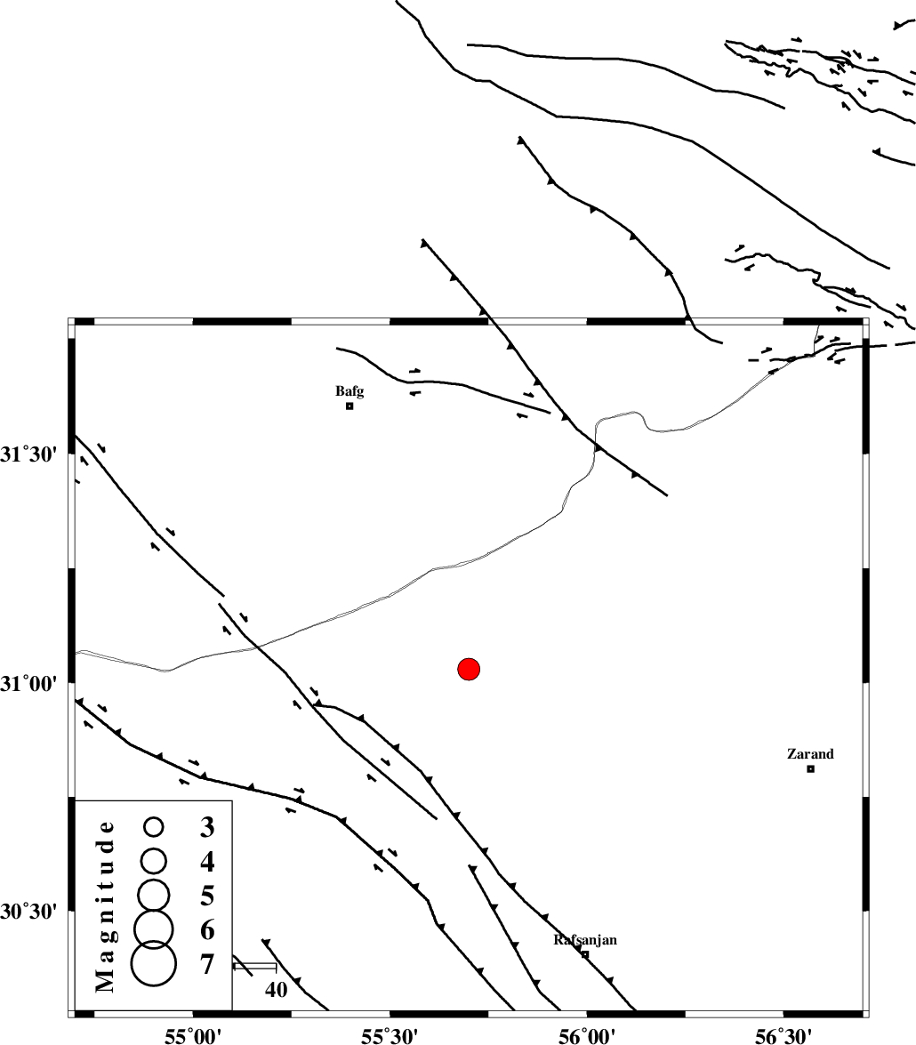
| Location | Lat:31.03 Lon: 55.7 |
| Region | Kerman Province, 70 km South-East of Bafq |
Nearest Cities |
|
| 13 km North of Esmaeelabad, Kerman Province | |
| 16 km North of Bahreman, Kerman Province | |
| 25 km North West of Ferdosiyeh, Kerman Province | |
| 27 km North West of Seyriz, Kerman Province | |
| 39 km North East of Hoseiynabad-e amin, Kerman Province | |
| Depth | 14 km |
| Agency | |
Faults within 150 km: |
|
| DARIVAN_F (Length: 131 km) , Distance to epicenter: 11 km | |
| ANAR_F (Length: 127 km) , Distance to epicenter: 47 km | |
| ANAR_F (Length: 91 km) , Distance to epicenter: 59 km | |
| Number of Phases | 5 |
| RMS | 0.3 |
| Number of Stations | 5 |
| Error in Latitude | >3.7 km |
| Error in Longitude | 6.5 km |
| Error in Depth | 6.4 km |
Download waveform in seisan format
to download seisan software Click here
to access information about IIEES stations Click here
Amplitude | ||||||||
| UID | Agency | Station | Component | Amplitude | Period | Arrival Time | Proccessing Time | Signal Clip |
| 91460 | IIEES | YZKH | E | 487.8 | 0.23 | 2014-01-13 06:32:59 | 2014-01-13 06:53:00 | n |
Phase | ||||||||||||
| Agency | Station | Component | Phase Type | Phase Quality | First Motion | Observed Arrival Time | Time Residual | Loc. Flag | Input Weight | Distance | Azimuth | |
| IIEES | KRBR | Z | Pg | E | 2014-01-13 06:32:27 | 0.02 | y | 154 | 138 | |||
| IIEES | YZKH | Z | Pg | E | 2014-01-13 06:32:32 | -0.16 | y | 184 | 326 | |||
| IIEES | TABS | Z | Pn | E | 2014-01-13 06:32:50 | 0.46 | y | 320 | 24 | |||
| IIEES | BSRN | Z | Pn | E | 2014-01-13 06:32:51 | -0.42 | y | 342 | 71 | |||
| IIEES | BNDS | Z | Pn | E | 2014-01-13 06:33:00 | 0.11 | y | 405 | 173 | |||
کلیه حقوق مادی و معنوی این سایت متعلق به پژوهشگاه بین المللی زلزله شناسی و مهندسی زلزله می باشد.
