خانه / مشخصات زلزله
Magnitude |
:2 |
| Date & Time (UTC) | 2014-02-18 20:51:39.4 |
| Date & Time (Local) | 1392/11/30 00:21:39.4 |
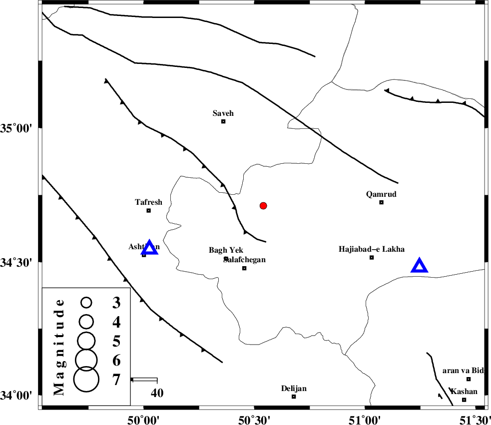
| Location | Lat:34.71 Lon: 50.54 |
| Region | Qom Province, 31 km West of Qom |
Nearest Cities |
|
| 8 km of Gazran, Qom Province | |
| 26 km South East of Qareh chay, Markazi Province | |
| 27 km North East of Bagh yek, Qom Province | |
| 27 km North of Salafchegan, Qom Province | |
| 28 km South of Taraznahid, Markazi Province | |
| Depth | 15 km |
| Agency | |
Faults within 150 km: |
|
| INDES_F (Length: 98 km) , Distance to epicenter: 12 km | |
| KUSHK_E_NOSRAT_F (Length: 230 km) , Distance to epicenter: 39 km | |
| TAFRESH_F (Length: 117 km) , Distance to epicenter: 63 km | |
| Number of Phases | 4 |
| RMS | 0 |
| Number of Stations | 3 |
| Error in Latitude | >1.3 km |
| Error in Longitude | 1.5 km |
| Error in Depth | 0 km |
Download waveform in seisan format
to download seisan software Click here
to access information about IIEES stations Click here
Amplitude | ||||||||
| UID | Agency | Station | Component | Amplitude | Period | Arrival Time | Proccessing Time | Signal Clip |
| 91821 | IIEES | GHVR | E | 75.2 | 0.28 | 2014-02-18 20:52:01 | 2014-02-19 03:24:00 | n |
| 91822 | IIEES | KHMZ | N | 41.1 | 0.32 | 2014-02-18 20:52:15 | 2014-02-19 03:24:00 | n |
Phase | ||||||||||||
| Agency | Station | Component | Phase Type | Phase Quality | First Motion | Observed Arrival Time | Time Residual | Loc. Flag | Input Weight | Distance | Azimuth | |
| IIEES | GHVR | Z | Pn | E | 2014-02-18 20:51:51 | y | 69.8 | 111 | ||||
| IIEES | GHVR | N | Sg | E | 2014-02-18 20:52:00 | -0.01 | y | 69.8 | 111 | |||
| IIEES | KHMZ | Z | Pg | E | 2014-02-18 20:51:59 | 0 | y | 120 | 206 | |||
| IIEES | CHTH | Z | Pg | E | 2014-02-18 20:52:03 | 0.01 | y | 144 | 22 | |||
کلیه حقوق مادی و معنوی این سایت متعلق به پژوهشگاه بین المللی زلزله شناسی و مهندسی زلزله می باشد.
