خانه / مشخصات زلزله
Magnitude |
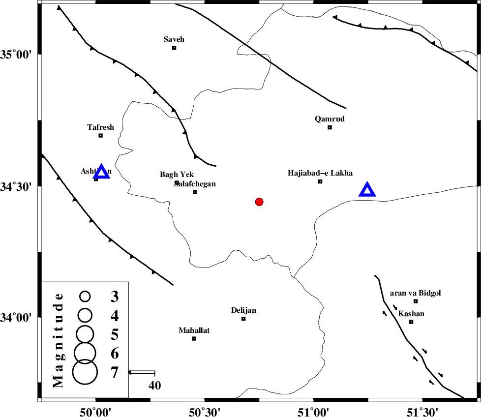
:2.2 |
| Date & Time (UTC) | 2014-03-07 02:37:20.4 |
| Date & Time (Local) | 1392/12/16 06:07:20.4 |
| Location | Lat:34.44 Lon: 50.75 |
| Region | Qom Province, 26 km South-West of Qom |
Nearest Cities |
|
| 13 km North West of Kahak, Qom Province | |
| 26 km South West of Qom, Qom Province | |
| 27 km West of Hajiabad-e lakha, Qom Province | |
| 27 km East of Salafchegan, Qom Province | |
| 34 km North West of Yahyaabad, Esfahan Province | |
| Depth | 15 km |
| Agency | |
Faults within 150 km: |
|
| INDES_F (Length: 98 km) , Distance to epicenter: 23 km | |
| TAFRESH_F (Length: 117 km) , Distance to epicenter: 51 km | |
| KUSHK_E_NOSRAT_F (Length: 230 km) , Distance to epicenter: 52 km | |
| Number of Phases | 3 |
| RMS | 0 |
| Number of Stations | 3 |
| Error in Latitude | >2.7 km |
| Error in Longitude | 1.6 km |
| Error in Depth | 0 km |
Download waveform in seisan format
to download seisan software Click here
to access information about IIEES stations Click here
Amplitude | ||||||||
| UID | Agency | Station | Component | Amplitude | Period | Arrival Time | Proccessing Time | Signal Clip |
| 91942 | IIEES | GHVR | E | 201.7 | 0.28 | 2014-03-07 02:37:36 | 2014-03-07 03:02:00 | n |
Phase | ||||||||||||
| Agency | Station | Component | Phase Type | Phase Quality | First Motion | Observed Arrival Time | Time Residual | Loc. Flag | Input Weight | Distance | Azimuth | |
| IIEES | GHVR | Z | Pg | E | 2014-03-07 02:37:28 | 0 | y | 45.6 | 84 | |||
| IIEES | ASAO | Z | Pg | E | 2014-03-07 02:37:32 | 0 | y | 67.8 | 281 | |||
| IIEES | KHMZ | Z | Pg | E | 2014-03-07 02:37:38 | 0 | y | 106 | 223 | |||
کلیه حقوق مادی و معنوی این سایت متعلق به پژوهشگاه بین المللی زلزله شناسی و مهندسی زلزله می باشد.
