خانه / مشخصات زلزله
Magnitude |
:2.7 |
| Date & Time (UTC) | 2014-05-12 16:03:19.1 |
| Date & Time (Local) | 1393/2/22 20:33:19.1 |
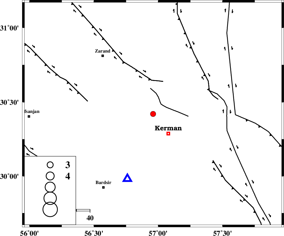
| Location | Lat:30.42 Lon: 56.96 |
| Region | Kerman Province, 19 km North-West of Kerman |
Nearest Cities |
|
| 5 km North of Zangiabad, Kerman Province | |
| 11 km North of Ekhtiyarabad, Kerman Province | |
| 17 km South of Hutak, Kerman Province | |
| 19 km North West of Kerman, Kerman Province | |
| 20 km South East of Kazemabad, Kerman Province | |
| Depth | 14 km |
| Agency | |
Faults within 150 km: |
|
| CHATRUD_F (Length: 37 km) , Distance to epicenter: 10 km | |
| KUHBANAN_F (Length: 189 km) , Distance to epicenter: 25 km | |
| LAKARKUH_F (Length: 138 km) , Distance to epicenter: 45 km | |
| Number of Phases | 4 |
| RMS | 0.1 |
| Number of Stations | 3 |
| Error in Latitude | >2.8 km |
| Error in Longitude | 3.3 km |
| Error in Depth | 5.3 km |
Download waveform in seisan format
to download seisan software Click here
to access information about IIEES stations Click here
Amplitude | ||||||||
| UID | Agency | Station | Component | Amplitude | Period | Arrival Time | Proccessing Time | Signal Clip |
| 92410 | IIEES | KRBR | E | 553.3 | 0.08 | 2014-05-12 16:03:38 | 2014-05-12 05:29:00 | n |
Phase | ||||||||||||
| Agency | Station | Component | Phase Type | Phase Quality | First Motion | Observed Arrival Time | Time Residual | Loc. Flag | Input Weight | Distance | Azimuth | |
| IIEES | KRBR | Z | Pg | E | 2014-05-12 16:03:28 | -0.03 | y | 51.7 | 201 | |||
| IIEES | BSRN | Z | Pn | E | 2014-05-12 16:04:00 | 0.11 | y | 269 | 50 | |||
| IIEES | BSRN | N | Sg | E | 2014-05-12 16:04:34 | -0.06 | y | 269 | 50 | |||
| IIEES | YZKH | Z | Pn | E | 2014-05-12 16:04:05 | -0.02 | y | 314 | 315 | |||
کلیه حقوق مادی و معنوی این سایت متعلق به پژوهشگاه بین المللی زلزله شناسی و مهندسی زلزله می باشد.
