خانه / مشخصات زلزله
Magnitude |
:3.3 |
| Date & Time (UTC) | 2014-07-30 07:46:13.7 |
| Date & Time (Local) | 1393/5/8 12:16:13.7 |
| Location | Lat:27.85 Lon: 57.87 |
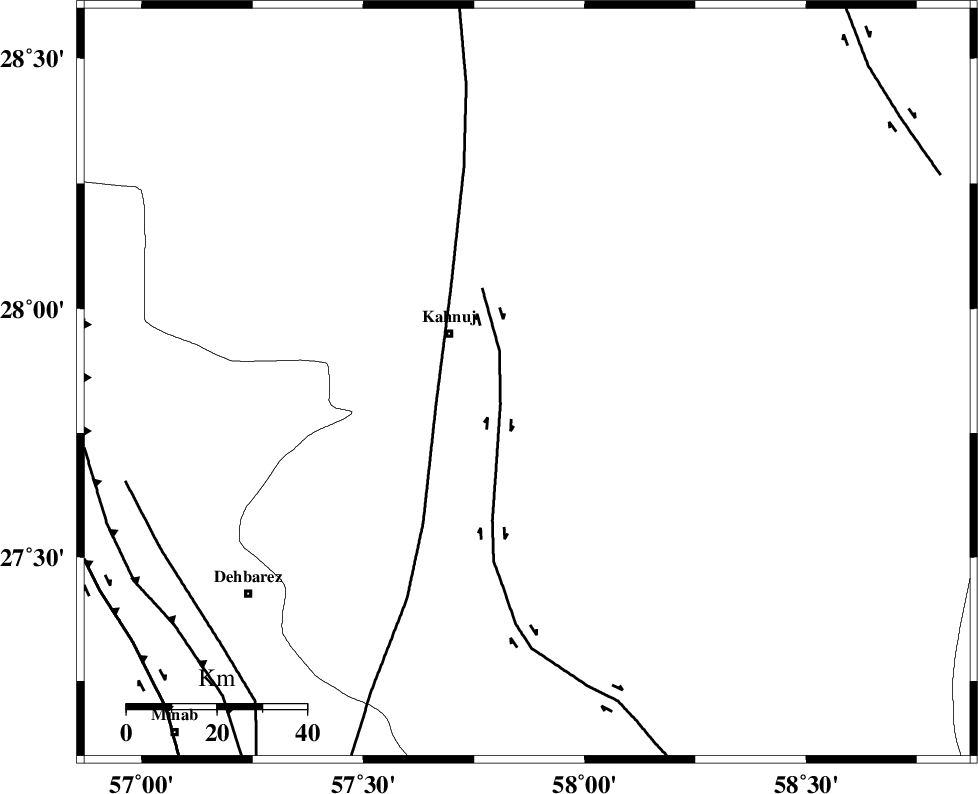
| Region | Kerman Province, 20 km South-East of Kahnuj |
Nearest Cities |
|
| 21 km South East of Kahnuj, Kerman Province | |
| 32 km North East of Bargah, Kerman Province | |
| 36 km North of Qalehy-eganj, Kerman Province | |
| 49 km North East of Bejogan, Kerman Province | |
| 51 km South East of Bolock, Kerman Province | |
| Depth | 16 km |
| Agency | |
Faults within 150 km: |
|
| JIROFT_F (Length: 144 km) , Distance to epicenter: 7 km | |
| SABZEVARAN_F (Length: 190 km) , Distance to epicenter: 21 km | |
| ZENDAN_MINAB_F_Z1 (Length: 183 km) , Distance to epicenter: 90 km | |
| Number of Phases | 6 |
| RMS | 0.3 |
| Number of Stations | 6 |
| Error in Latitude | >4.5 km |
| Error in Longitude | 4.8 km |
| Error in Depth | 11.6 km |
Download waveform in seisan format
to download seisan software Click here
to access information about IIEES stations Click here
Amplitude | ||||||||
| UID | Agency | Station | Component | Amplitude | Period | Arrival Time | Proccessing Time | Signal Clip |
| 92895 | IIEES | BNDS | N | 344.9 | 0.31 | 2014-07-30 07:47:06 | 2014-07-30 11:14:00 | n |
Phase | ||||||||||||
| Agency | Station | Component | Phase Type | Phase Quality | First Motion | Observed Arrival Time | Time Residual | Loc. Flag | Input Weight | Distance | Azimuth | |
| IIEES | BNDS | Z | Pg | E | 2014-07-30 07:46:42 | 0 | y | 174 | 254 | |||
| IIEES | ZHSF | Z | Pn | E | 2014-07-30 07:47:04 | 0.1 | y | 345 | 55 | |||
| IIEES | CHBR | Z | Pn | E | 2014-07-30 07:47:05 | 0.01 | y | 360 | 133 | |||
| IIEES | BSRN | Z | Pn | E | 2014-07-30 07:47:19 | -0.49 | y | 473 | 15 | |||
| IIEES | GHIR | Z | Pn | E | 2014-07-30 07:47:21 | -0.06 | y | 482 | 277 | |||
| IIEES | TABS | Z | Pn | E | 2014-07-30 07:47:42 | 0.58 | y | 647 | 354 | |||
کلیه حقوق مادی و معنوی این سایت متعلق به پژوهشگاه بین المللی زلزله شناسی و مهندسی زلزله می باشد.
