خانه / مشخصات زلزله
Magnitude |
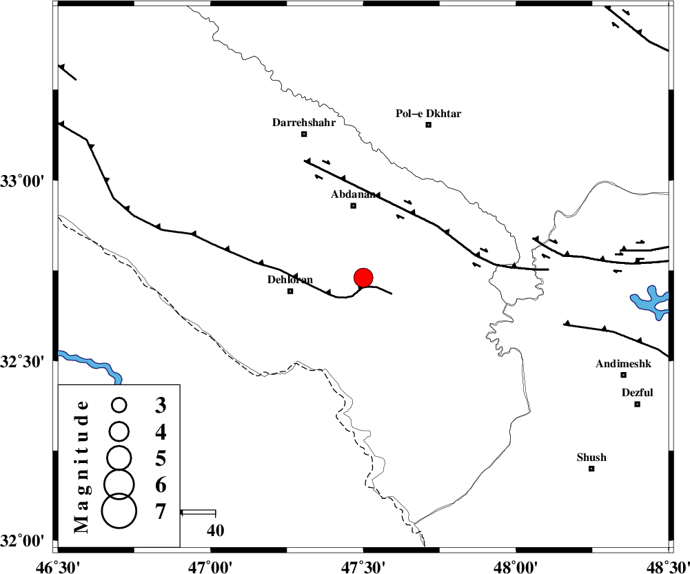
:3.9 |
| Date & Time (UTC) | 2014-08-20 18:45:40.3 |
| Date & Time (Local) | 1393/5/29 23:15:40.3 |
| Location | Lat:32.73 Lon: 47.5 |
| Region | Ilam Province, 22 km South of Abdanan |
Nearest Cities |
|
| 20 km South of Sarabbagh, Ilam Province | |
| 22 km South of Abdanan, Ilam Province | |
| 23 km North East of Dehloran, Ilam Province | |
| 24 km North East of Musian, Ilam Province | |
| 44 km South West of Sarab hammam, Lorestan Province | |
| Depth | 17 km |
| Agency | |
Faults within 150 km: |
|
| MFF6 (Length: 144 km) , Distance to epicenter: 3 km | |
| BALARUD_F_Z1 (Length: 87 km) , Distance to epicenter: 28 km | |
| BALARUD_F_Z3 (Length: 53 km) , Distance to epicenter: 53 km | |
| Number of Phases | 7 |
| RMS | 0.1 |
| Number of Stations | 5 |
| Error in Latitude | >2.7 km |
| Error in Longitude | 2.8 km |
| Error in Depth | 5.3 km |
Download waveform in seisan format
to download seisan software Click here
to access information about IIEES stations Click here
Amplitude | ||||||||
| UID | Agency | Station | Component | Amplitude | Period | Arrival Time | Proccessing Time | Signal Clip |
| 93181 | IIEES | AHRM | E | 74.5 | 0.56 | 2014-08-20 18:47:56 | 2014-08-20 09:07:00 | n |
| 93182 | IIEES | AHRM | N | 63.3 | 0.4 | 2014-08-20 18:47:57 | 2014-08-20 09:07:00 | n |
Phase | ||||||||||||
| Agency | Station | Component | Phase Type | Phase Quality | First Motion | Observed Arrival Time | Time Residual | Loc. Flag | Input Weight | Distance | Azimuth | |
| IIEES | KHMZ | Z | Pn | E | 2014-08-20 18:46:19 | -0.08 | y | 256 | 63 | |||
| IIEES | KHMZ | Z | Sg | E | 2014-08-20 18:46:52 | 0.06 | y | 256 | 63 | |||
| IIEES | SNGE | Z | Pn | E | 2014-08-20 18:46:20 | 0.16 | y | 262 | 357 | |||
| IIEES | SNGE | N | Sg | E | 2014-08-20 18:46:54 | -0.06 | y | 262 | 357 | |||
| IIEES | CHTH | Z | Pn | E | 2014-08-20 18:46:48 | -0.06 | y | 486 | 42 | |||
| IIEES | DAMV | Z | Pn | E | 2014-08-20 18:46:52 | -0.04 | y | 523 | 51 | |||
| IIEES | AHRM | Z | Pn | E | 2014-08-20 18:46:57 | -0.01 | y | 562 | 139 | |||
کلیه حقوق مادی و معنوی این سایت متعلق به پژوهشگاه بین المللی زلزله شناسی و مهندسی زلزله می باشد.
