خانه / مشخصات زلزله
Magnitude |
:4.2 |
| Date & Time (UTC) | 2014-08-21 23:15:29.5 |
| Date & Time (Local) | 1393/5/31 03:45:29.5 |
| Location | Lat:32.78 Lon: 47.42 |
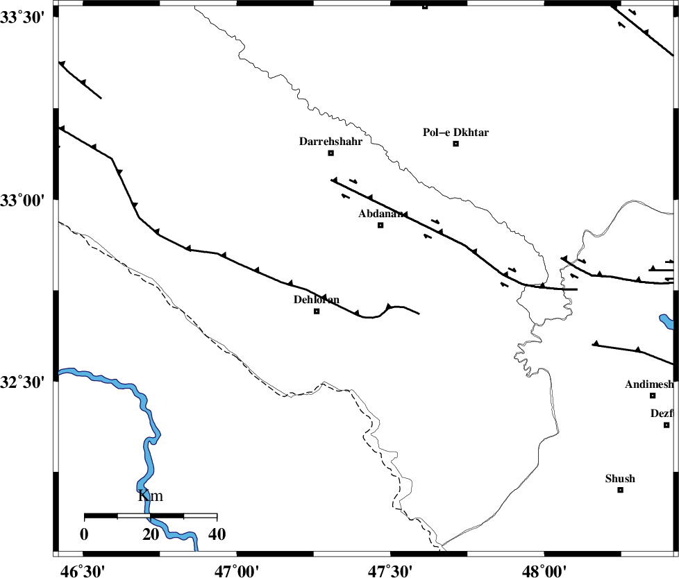
| Region | Ilam Province, 18 km South of Abdanan |
Nearest Cities |
|
| 17 km South of Abdanan, Ilam Province | |
| 18 km North East of Dehloran, Ilam Province | |
| 19 km South West of Sarabbagh, Ilam Province | |
| 27 km North of Musian, Ilam Province | |
| 40 km South East of Darreh Shahr, Ilam Province | |
| Depth | 14 km |
| Agency | |
Faults within 150 km: |
|
| MFF6 (Length: 144 km) , Distance to epicenter: 11 km | |
| BALARUD_F_Z1 (Length: 87 km) , Distance to epicenter: 32 km | |
| BALARUD_F_Z3 (Length: 53 km) , Distance to epicenter: 60 km | |
| Number of Phases | 5 |
| RMS | 0.1 |
| Number of Stations | 6 |
| Error in Latitude | >23.7 km |
| Error in Longitude | 17.9 km |
| Error in Depth | 34.3 km |
Download waveform in seisan format
to download seisan software Click here
to access information about IIEES stations Click here
Amplitude | ||||||||
| UID | Agency | Station | Component | Amplitude | Period | Arrival Time | Proccessing Time | Signal Clip |
| 93197 | IIEES | AHRM | E | 159 | 0.6 | 2014-08-21 23:18:33 | 2014-08-22 12:48:00 | n |
| 93198 | IIEES | AHRM | N | 286.4 | 0.6 | 2014-08-21 23:18:35 | 2014-08-22 12:48:00 | n |
| 93199 | IIEES | YZKH | E | 26.7 | 0.68 | 2014-08-21 23:18:57 | 2014-08-22 12:48:00 | n |
Phase | ||||||||||||
| Agency | Station | Component | Phase Type | Phase Quality | First Motion | Observed Arrival Time | Time Residual | Loc. Flag | Input Weight | Distance | Azimuth | |
| IIEES | SNGE | Z | Pn | E | 2014-08-21 23:16:09 | -0.09 | y | 257 | 359 | |||
| IIEES | SNGE | N | Sg | E | 2014-08-21 23:16:42 | 0 | y | 257 | 359 | |||
| IIEES | KHMZ | Z | Pn | E | 2014-08-21 23:16:09 | 0.03 | y | 260 | 65 | |||
| IIEES | ZNJK | Z | Pn | E | 2014-08-21 23:16:33 | 0.23 | y | 448 | 15 | |||
| IIEES | CHTH | Z | Pn | E | 2014-08-21 23:16:37 | -0.15 | y | 487 | 43 | |||
کلیه حقوق مادی و معنوی این سایت متعلق به پژوهشگاه بین المللی زلزله شناسی و مهندسی زلزله می باشد.
