خانه / مشخصات زلزله
Magnitude |
:3.4 |
| Date & Time (UTC) | 2014-08-23 03:19:44.9 |
| Date & Time (Local) | 1393/6/1 07:49:44.9 |
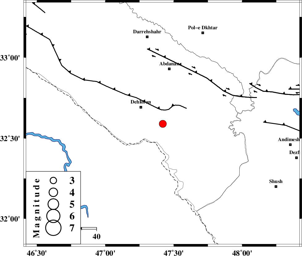
| Location | Lat:32.59 Lon: 47.42 |
| Region | Ilam Province, 18 km South-East of Dehloran |
Nearest Cities |
|
| 7 km North of Musian, Ilam Province | |
| 19 km South East of Dehloran, Ilam Province | |
| 37 km South West of Sarabbagh, Ilam Province | |
| 38 km South of Abdanan, Ilam Province | |
| 49 km South East of Bishehzar, Ilam Province | |
| Depth | 16 km |
| Agency | |
Faults within 150 km: |
|
| MFF6 (Length: 144 km) , Distance to epicenter: 10 km | |
| BALARUD_F_Z1 (Length: 87 km) , Distance to epicenter: 44 km | |
| BALARUD_F_Z3 (Length: 53 km) , Distance to epicenter: 66 km | |
| Number of Phases | 5 |
| RMS | 0 |
| Number of Stations | 3 |
| Error in Latitude | >2.9 km |
| Error in Longitude | 5.1 km |
| Error in Depth | 3.6 km |
Download waveform in seisan format
to download seisan software Click here
to access information about IIEES stations Click here
Amplitude | ||||||||
| UID | Agency | Station | Component | Amplitude | Period | Arrival Time | Proccessing Time | Signal Clip |
| 93230 | IIEES | SHGR | E | 528.7 | 0.38 | 2014-08-23 03:20:35 | 2014-08-23 07:21:00 | n |
| 93231 | IIEES | SHGR | N | 737.6 | 0.62 | 2014-08-23 03:20:35 | 2014-08-23 07:21:00 | n |
Phase | ||||||||||||
| Agency | Station | Component | Phase Type | Phase Quality | First Motion | Observed Arrival Time | Time Residual | Loc. Flag | Input Weight | Distance | Azimuth | |
| IIEES | SHGR | Z | Pg | E | 2014-08-23 03:20:08 | -0.05 | y | 141 | 112 | |||
| IIEES | SHGR | N | Sg | E | 2014-08-23 03:20:25 | 0.05 | y | 141 | 112 | |||
| IIEES | KHMZ | Z | Pn | E | 2014-08-23 03:20:26 | -0.05 | y | 269 | 61 | |||
| IIEES | SNGE | Z | Pn | E | 2014-08-23 03:20:27 | 0.05 | y | 277 | 359 | |||
| IIEES | SNGE | N | Sg | E | 2014-08-23 03:21:03 | 0 | y | 277 | 359 | |||
کلیه حقوق مادی و معنوی این سایت متعلق به پژوهشگاه بین المللی زلزله شناسی و مهندسی زلزله می باشد.
