سبد خرید خالی است.
خانه / مشخصات زلزله
Magnitude |
:2.5 |
| Date & Time (UTC) | 2014-09-03 22:47:23.3 |
| Date & Time (Local) | 1393/6/13 03:17:23.3 |
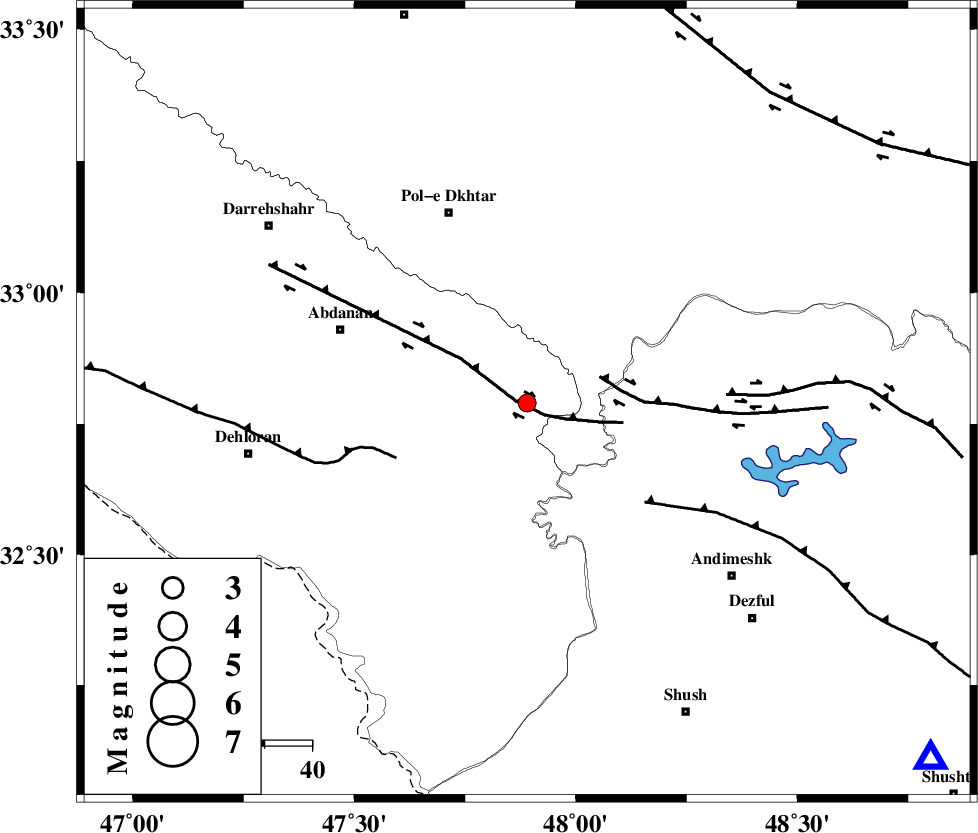
| Location | Lat:32.79 Lon: 47.89 |
| Region | Ilam Province, 44 km South-East of Pol-e dokhtar |
Nearest Cities |
|
| 33 km South East of Sarabbagh, Ilam Province | |
| 33 km North West of Bidruyeh, Khoozestan Province | |
| 36 km North West of Hoseinieh, Khoozestan Province | |
| 39 km South East of Sarab hammam, Lorestan Province | |
| 41 km North West of Sorkhakan, Khoozestan Province | |
| Depth | 14 km |
| Agency | |
Faults within 150 km: |
|
| BALARUD_F_Z1 (Length: 87 km) , Distance to epicenter: 2 km | |
| BALARUD_F_Z3 (Length: 53 km) , Distance to epicenter: 16 km | |
| MFF6 (Length: 144 km) , Distance to epicenter: 30 km | |
| Number of Phases | 6 |
| RMS | 0.2 |
| Number of Stations | 4 |
| Error in Latitude | >1.9 km |
| Error in Longitude | 5.1 km |
| Error in Depth | 7 km |
Download waveform in seisan format
to download seisan software Click here
to access information about IIEES stations Click here
Amplitude | ||||||||
| UID | Agency | Station | Component | Amplitude | Period | Arrival Time | Proccessing Time | Signal Clip |
| 93461 | IIEES | SHGR | N | 131.4 | 0.26 | 2014-09-03 22:48:01 | 2014-09-04 03:57:00 | n |
| 93462 | IIEES | SNGE | N | 21 | 0.46 | 2014-09-03 22:48:42 | 2014-09-04 03:57:00 | n |
Phase | ||||||||||||
| Agency | Station | Component | Phase Type | Phase Quality | First Motion | Observed Arrival Time | Time Residual | Loc. Flag | Input Weight | Distance | Azimuth | |
| IIEES | SHGR | Z | Pg | E | 2014-09-03 22:47:42 | -0.14 | y | 114 | 131 | |||
| IIEES | SHGR | E | Sg | E | 2014-09-03 22:47:56 | 0.14 | y | 114 | 131 | |||
| IIEES | KHMZ | Z | Pn | E | 2014-09-03 22:47:58 | -0.28 | y | 220 | 61 | |||
| IIEES | SNGE | Z | Pn | E | 2014-09-03 22:48:03 | 0.06 | y | 261 | 349 | |||
| IIEES | ASAO | Z | Pn | E | 2014-09-03 22:48:05 | 0.24 | y | 278 | 45 | |||
| IIEES | ASAO | N | Sg | E | 2014-09-03 22:48:41 | 0 | y | 278 | 45 | |||
کلیه حقوق مادی و معنوی این سایت متعلق به پژوهشگاه بین المللی زلزله شناسی و مهندسی زلزله می باشد.
