خانه / مشخصات زلزله
Magnitude |
:2.6 |
| Date & Time (UTC) | 2014-09-23 01:22:35.9 |
| Date & Time (Local) | 1393/7/1 04:52:35.9 |
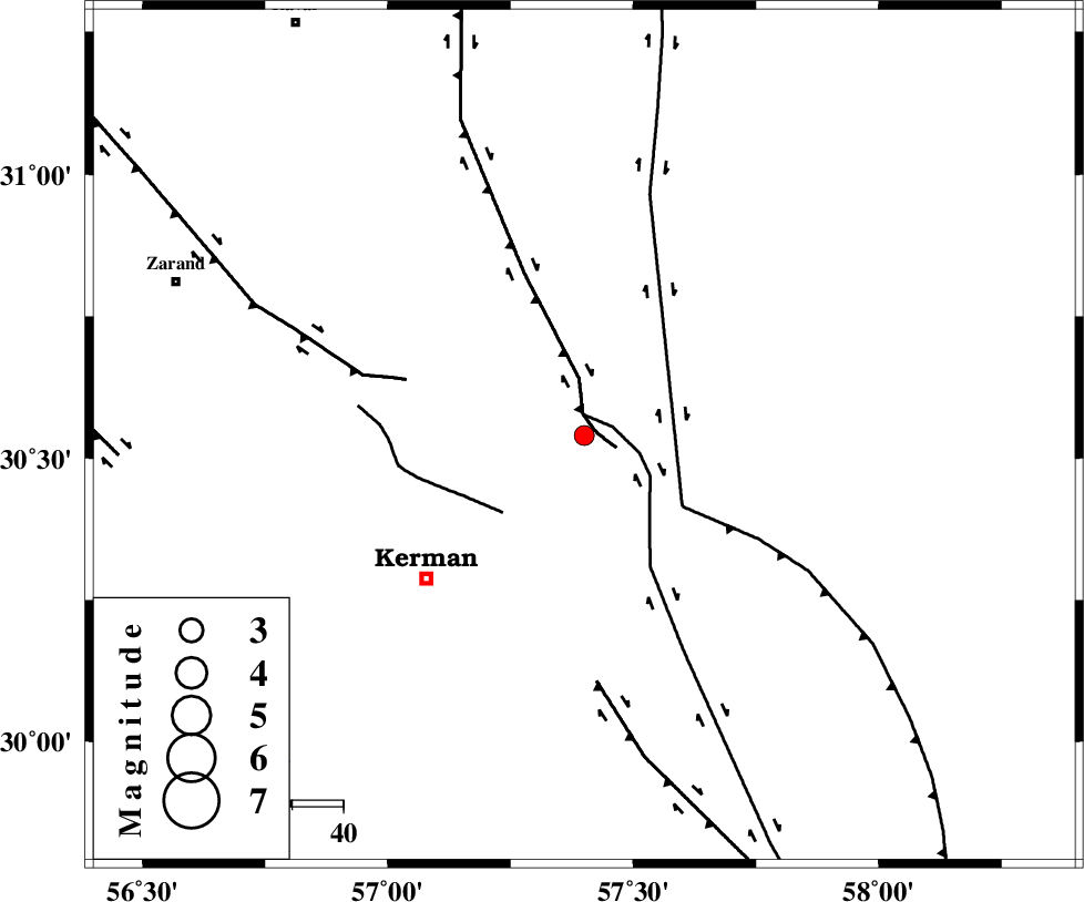
| Location | Lat:30.54 Lon: 57.4 |
| Region | Kerman Province, 41 km North-East of Kerman |
Nearest Cities |
|
| 13 km North East of Dehlulu, Kerman Province | |
| 29 km South East of Harjand, Kerman Province | |
| 32 km North West of Shahdad, Kerman Province | |
| 38 km North East of Sarasiyab-e ferangi, Kerman Province | |
| 41 km North West of Sirch, Kerman Province | |
| Depth | 18 km |
| Agency | |
Faults within 150 km: |
|
| LAKARKUH_F (Length: 138 km) , Distance to epicenter: 3 km | |
| GOLBAF_SIRCH_F (Length: 114 km) , Distance to epicenter: 4 km | |
| CHATRUD_F (Length: 37 km) , Distance to epicenter: 22 km | |
| Number of Phases | 5 |
| RMS | 0.2 |
| Number of Stations | 3 |
| Error in Latitude | >2.5 km |
| Error in Longitude | 3.5 km |
| Error in Depth | 5.2 km |
Download waveform in seisan format
to download seisan software Click here
to access information about IIEES stations Click here
Amplitude | ||||||||
| UID | Agency | Station | Component | Amplitude | Period | Arrival Time | Proccessing Time | Signal Clip |
| 93662 | IIEES | TABS | N | 15.6 | 0.44 | 2014-09-23 01:24:24 | 2014-09-23 02:02:00 | n |
Phase | ||||||||||||
| Agency | Station | Component | Phase Type | Phase Quality | First Motion | Observed Arrival Time | Time Residual | Loc. Flag | Input Weight | Distance | Azimuth | |
| IIEES | KRBR | Z | Pg | E | 2014-09-23 01:22:51 | 0.13 | y | 87 | 225 | |||
| IIEES | BSRN | Z | Pn | E | 2014-09-23 01:23:11 | -0.36 | y | 228 | 46 | |||
| IIEES | BSRN | N | Sg | E | 2014-09-23 01:23:40 | 0.24 | y | 228 | 46 | |||
| IIEES | TABS | Z | Pn | E | 2014-09-23 01:23:26 | -0.01 | y | 346 | 356 | |||
| IIEES | TABS | E | Sg | E | 2014-09-23 01:24:13 | 0 | y | 346 | 356 | |||
کلیه حقوق مادی و معنوی این سایت متعلق به پژوهشگاه بین المللی زلزله شناسی و مهندسی زلزله می باشد.
