خانه / مشخصات زلزله
Magnitude |
:3.1 |
| Date & Time (UTC) | 2015-03-10 18:20:33.8 |
| Date & Time (Local) | 1393/12/19 21:50:33.8 |
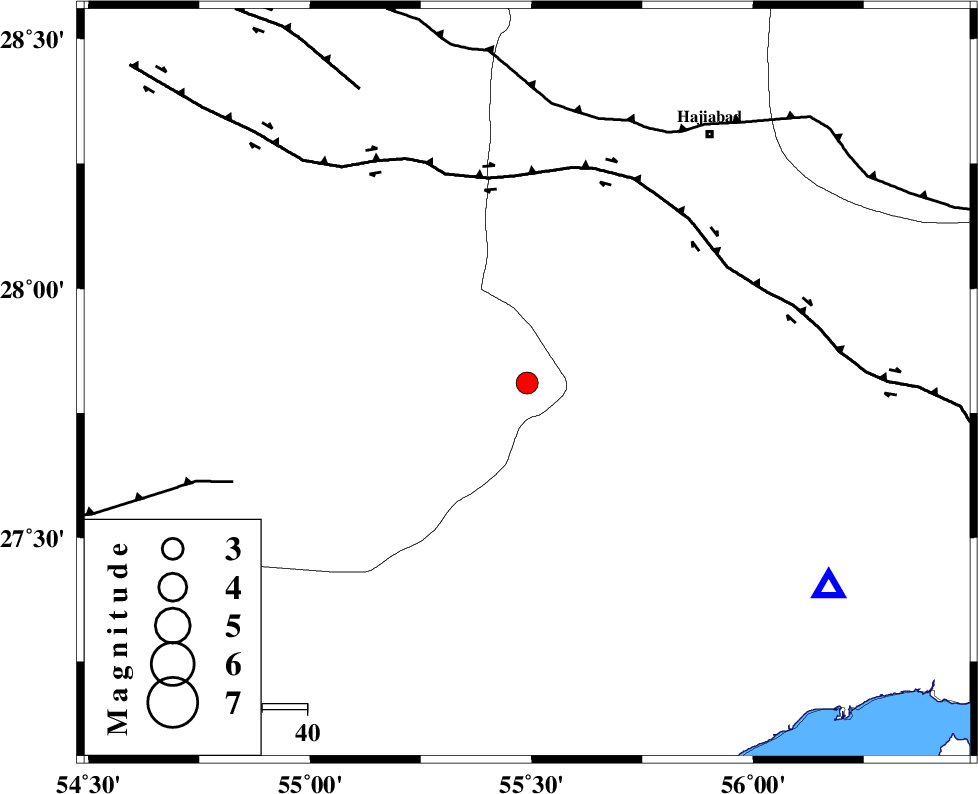
| Location | Lat:27.81 Lon: 55.49 |
| Region | Fars Province, 69 km South-West of Hajiabad |
Nearest Cities |
|
| 9 km of Darz, Fars Province | |
| 45 km North West of Fin, Hormozgan Province | |
| 53 km South East of Fadami, Fars Province | |
| 62 km South East of Doborji, Fars Province | |
| 69 km South West of Hajiabad, Hormozgan Province | |
| Depth | 14 km |
| Agency | |
Faults within 150 km: |
|
| HZF2 (Length: 437 km) , Distance to epicenter: 46 km | |
| MAIN_ZAGROS_R_F (Length: 1106 km) , Distance to epicenter: 61 km | |
| LAR_F (Length: 99 km) , Distance to epicenter: 69 km | |
| Number of Phases | 4 |
| RMS | 0 |
| Number of Stations | 3 |
| Error in Latitude | >1.5 km |
| Error in Longitude | 8.1 km |
| Error in Depth | 8.2 km |
Download waveform in seisan format
to download seisan software Click here
to access information about IIEES stations Click here
Amplitude | ||||||||
| UID | Agency | Station | Component | Amplitude | Period | Arrival Time | Proccessing Time | Signal Clip |
| 95206 | IIEES | BNDS | N | 725.7 | 0.36 | 2015-03-10 18:21:05 | 2015-03-10 06:36:00 | n |
Phase | ||||||||||||
| Agency | Station | Component | Phase Type | Phase Quality | First Motion | Observed Arrival Time | Time Residual | Loc. Flag | Input Weight | Distance | Azimuth | |
| IIEES | BNDS | Z | Pg | E | 2015-03-10 18:20:47 | -0.01 | y | 81.6 | 124 | |||
| IIEES | KRBR | Z | Pn | E | 2015-03-10 18:21:15 | 0.05 | y | 271 | 27 | |||
| IIEES | KRBR | E | Sg | E | 2015-03-10 18:21:50 | -0.01 | y | 271 | 27 | |||
| IIEES | YZKH | Z | Pn | E | 2015-03-10 18:21:45 | -0.05 | y | 515 | 351 | |||
کلیه حقوق مادی و معنوی این سایت متعلق به پژوهشگاه بین المللی زلزله شناسی و مهندسی زلزله می باشد.
