خانه / مشخصات زلزله
Magnitude |
:2.3 |
| Date & Time (UTC) | 2015-04-08 00:36:56.5 |
| Date & Time (Local) | 1394/1/19 05:06:56.5 |
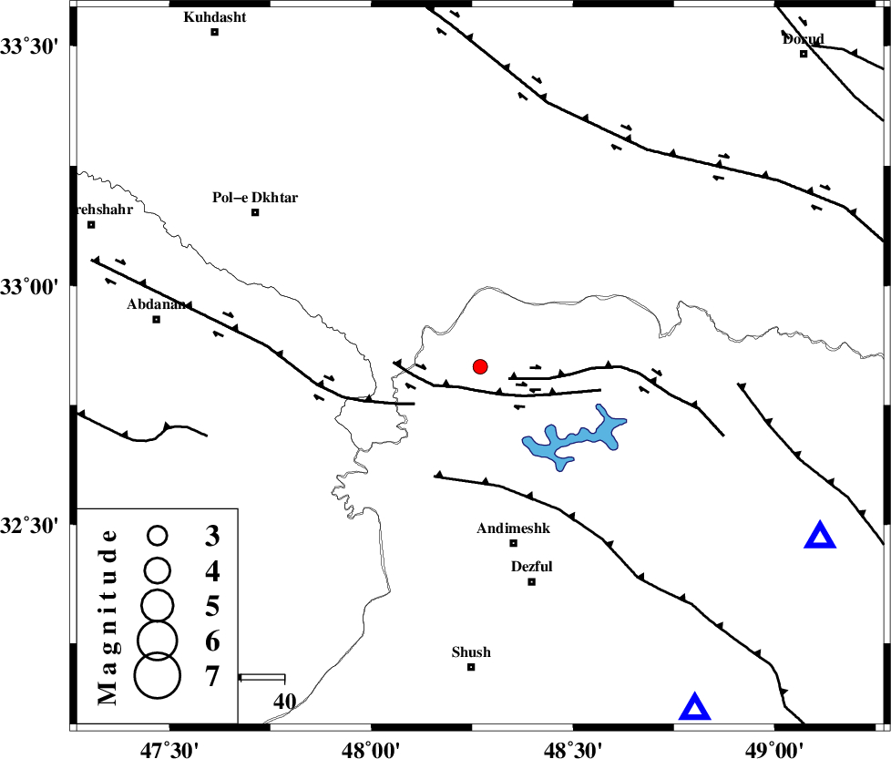
| Location | Lat:32.83 Lon: 48.27 |
| Region | Khoozestan Province, 42 km North of Andimeshk |
Nearest Cities |
|
| 8 km North of Sorkhakan, Khoozestan Province | |
| 9 km North of Bidruyeh, Khoozestan Province | |
| 17 km North of Hoseinieh, Khoozestan Province | |
| 42 km North of Andimeshk, Khoozestan Province | |
| 51 km North West of Shuy, Khoozestan Province | |
| Depth | 15 km |
| Agency | |
Faults within 150 km: |
|
| BALARUD_F_Z3 (Length: 53 km) , Distance to epicenter: 5 km | |
| BALARUD_F_Z2 (Length: 58 km) , Distance to epicenter: 7 km | |
| BALARUD_F_Z1 (Length: 87 km) , Distance to epicenter: 17 km | |
| Number of Phases | 3 |
| RMS | 0 |
| Number of Stations | 3 |
| Error in Latitude | >1.8 km |
| Error in Longitude | 9.2 km |
| Error in Depth | 0 km |
Download waveform in seisan format
to download seisan software Click here
to access information about IIEES stations Click here
Amplitude | ||||||||
| UID | Agency | Station | Component | Amplitude | Period | Arrival Time | Proccessing Time | Signal Clip |
| 95359 | IIEES | SHGR | N | 93.7 | 0.48 | 2015-04-08 00:37:33 | 2015-04-08 02:36:00 | n |
| 95360 | IIEES | SHGR | E | 114.9 | 0.76 | 2015-04-08 00:37:34 | 2015-04-08 02:36:00 | n |
Phase | ||||||||||||
| Agency | Station | Component | Phase Type | Phase Quality | First Motion | Observed Arrival Time | Time Residual | Loc. Flag | Input Weight | Distance | Azimuth | |
| IIEES | SHGR | Z | Pg | E | 2015-04-08 00:37:12 | -0.01 | y | 94.1 | 148 | |||
| IIEES | KHMZ | Z | Pg | E | 2015-04-08 00:37:27 | 0 | y | 187 | 57 | |||
| IIEES | ASAO | Z | Pn | E | 2015-04-08 00:37:35 | 0.01 | y | 250 | 40 | |||
کلیه حقوق مادی و معنوی این سایت متعلق به پژوهشگاه بین المللی زلزله شناسی و مهندسی زلزله می باشد.
