خانه / مشخصات زلزله
Magnitude |
:2.6 |
| Date & Time (UTC) | 2015-05-15 00:31:41.0 |
| Date & Time (Local) | 1394/2/25 05:01:41.0 |
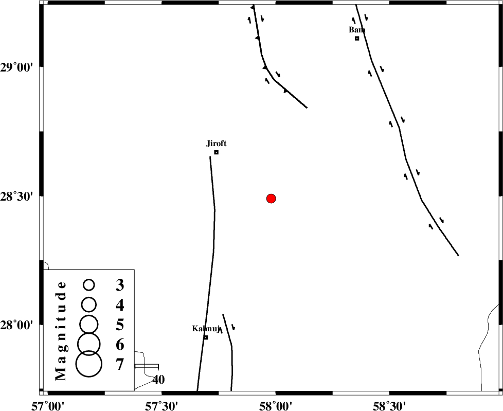
| Location | Lat:28.49 Lon: 57.98 |
| Region | Kerman Province, 31 km South-East of Jiroft |
Nearest Cities |
|
| 8 km North of Dosari, Kerman Province | |
| 12 km North East of Aliabad-e qadiri, Kerman Province | |
| 14 km South of Dahane-ye gomrokan, Kerman Province | |
| 14 km East of Khesrabad, Kerman Province | |
| 21 km South East of Dolatabad, Kerman Province | |
| Depth | 15 km |
| Agency | |
Faults within 150 km: |
|
| SABZEVARAN_F (Length: 190 km) , Distance to epicenter: 25 km | |
| GOWK_F (Length: 152 km) , Distance to epicenter: 42 km | |
| JIROFT_F (Length: 144 km) , Distance to epicenter: 54 km | |
| Number of Phases | 3 |
| RMS | 0 |
| Number of Stations | 3 |
| Error in Latitude | >2.3 km |
| Error in Longitude | 3.9 km |
| Error in Depth | 0 km |
Download waveform in seisan format
to download seisan software Click here
to access information about IIEES stations Click here
Amplitude | ||||||||
| UID | Agency | Station | Component | Amplitude | Period | Arrival Time | Proccessing Time | Signal Clip |
| 95676 | IIEES | BNDS | N | 44.7 | 0.64 | 2015-05-15 00:32:52 | 2015-05-15 05:02:00 | n |
| 95677 | IIEES | BSRN | E | 10.2 | 0.48 | 2015-05-15 00:33:37 | 2015-05-15 05:02:00 | n |
| 95678 | IIEES | BSRN | N | 10 | 0.44 | 2015-05-15 00:33:41 | 2015-05-15 05:02:00 | n |
Phase | ||||||||||||
| Agency | Station | Component | Phase Type | Phase Quality | First Motion | Observed Arrival Time | Time Residual | Loc. Flag | Input Weight | Distance | Azimuth | |
| IIEES | KRBR | Z | Pg | E | 2015-05-15 00:32:14 | -0.01 | y | 204 | 325 | |||
| IIEES | BNDS | Z | Pg | E | 2015-05-15 00:32:16 | 0.01 | y | 215 | 236 | |||
| IIEES | BSRN | Z | Pn | E | 2015-05-15 00:32:38 | 0.01 | y | 401 | 16 | |||
کلیه حقوق مادی و معنوی این سایت متعلق به پژوهشگاه بین المللی زلزله شناسی و مهندسی زلزله می باشد.
