| Prel. Rep. | Date | Time(UTC) | Time(Local) | Lat. | Lon. | Depth | Mag. | Region | Waveform |
|
|
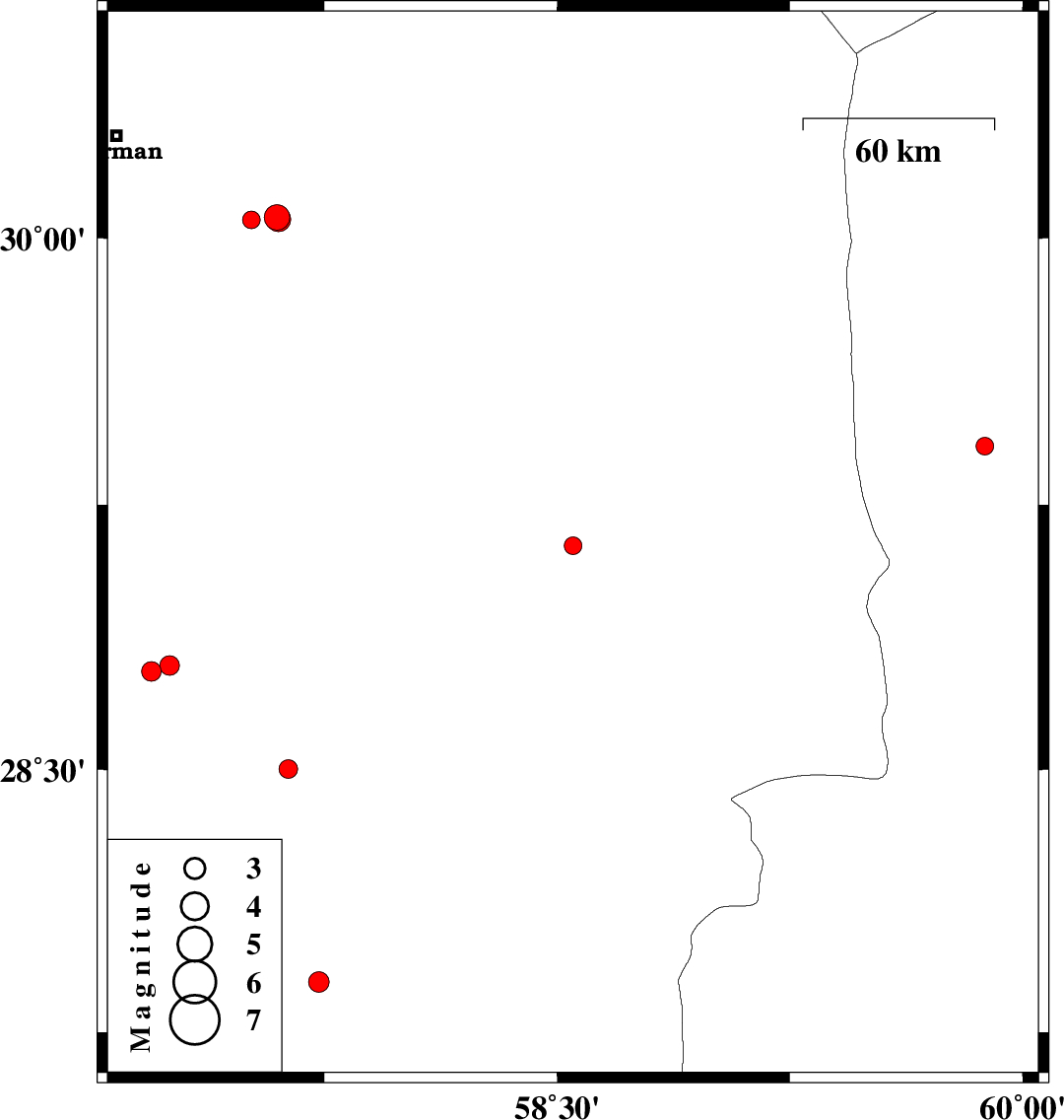
2016/11/27
|
15:20:05.6
|
18:50:05.6
| 29.135 | 58.551 | 14 |
ML2.5
|
Kerman Province, 19 km -East of Bam | |
|
|
2016/11/12
|
10:19:34.4
|
13:49:34.4
| 29.415 | 59.879 | 18 |
ML2.5
|
Sistan va Baloochestan Province, 96 km -West of Zahedan | |
|
|
2016/11/12
|
02:41:55.4
|
06:11:55.4
| 28.778 | 57.193 | 17 |
ML2.8
|
Kerman Province, 55 km North-West of Jiroft | |
|
|
2016/11/10
|
15:20:09.5
|
18:50:09.5
| 30.058 | 57.597 | 7 |
ML3.6
|
Kerman Province, 56 km South-East of Kerman | |
|
|
2016/11/10
|
14:33:41.7
|
18:03:41.7
| 28.795 | 57.251 | 16 |
ML2.8
|
Kerman Province, 50 km North-West of Jiroft | |
|
|
2016/11/10
|
13:12:11.8
|
16:42:11.8
| 30.051 | 57.514 | 6 |
ML2.6
|
Kerman Province, 49 km South-East of Kerman | |
|
|
2016/11/10
|
06:48:10.4
|
10:18:10.4
| 30.053 | 57.602 | 7 |
ML3.5
|
Kerman Province, 57 km South-East of Kerman | |
|
|
2016/11/09
|
01:26:56.1
|
04:56:56.1
| 28.24 | 57.346 | 15 |
ML3
|
Kerman Province, 47 km North-West of Kahnuj | |
|
|
2016/11/09
|
01:15:22.5
|
04:45:22.5
| 28.196 | 57.404 | 15 |
ML4.2
|
Kerman Province, 39 km North-West of Kahnuj | |
|
|
2016/11/09
|
01:05:30.1
|
04:35:30.1
| 28.22 | 57.303 | 15 |
ML3.2
|
Kerman Province, 49 km North-West of Kahnuj | |
|
|
2016/11/05
|
17:28:21.7
|
20:58:21.7
| 27.894 | 57.732 | 16 |
ML3
|
Kerman Province, 7 km of Kahnuj | |
|
|
2016/10/31
|
06:55:53.2
|
10:25:53.2
| 28.501 | 57.634 | 14 |
ML2.7
|
Kerman Province, 21 km South-West of Jiroft | |