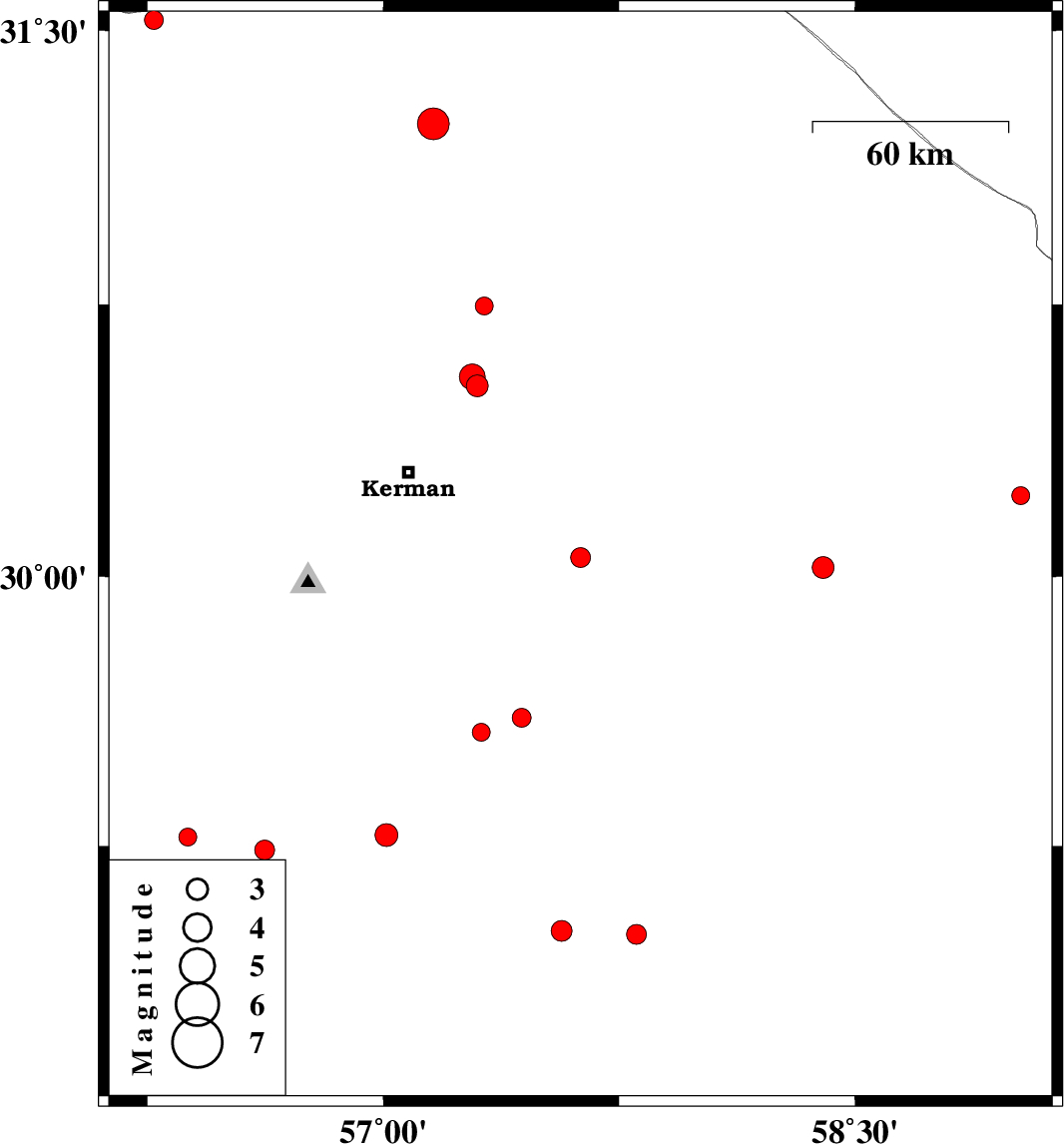
| Prel. Rep. | Date | Time(UTC) | Time(Local) | Lat. | Lon. | Depth | Mag. | Region | Waveform |
|
|
2017/05/17
|
18:04:22.0
|
22:34:22.0
| 30.052 | 57.627 | 18 |
ML2.8
|
Kerman Province, 59 km South-East of Kerman | |
|
|
2017/05/15
|
05:43:08.1
|
10:13:08.1
| 29.281 | 57.01 | 15 |
ML3.2
|
Kerman Province, 39 km -East of Baft | |
|
|
2017/05/14
|
17:42:49.3
|
22:12:49.3
| 29.275 | 56.378 | 36 |
ML2.6
|
Kerman Province, 23 km -West of Baft | |
|
|
2017/05/13
|
04:57:47.2
|
09:27:47.2
| 30.746 | 57.321 | 14 |
ML2.5
|
Kerman Province, 56 km North-East of Kerman | |
|
|
2017/05/09
|
01:48:12.9
|
06:18:12.9
| 31.245 | 57.159 | 15 |
ML4.5
|
Kerman Province, 33 km -East of Ravar | |
|
|
2017/05/08
|
16:35:32.2
|
21:05:32.2
| 30.526 | 57.298 | 14 |
ML3.1
|
Kerman Province, 34 km North-East of Kerman | |
|
|
2017/05/05
|
15:53:43.8
|
20:23:43.8
| 29.239 | 56.623 | 14 |
ML2.8
|
Kerman Province, 1 km of Baft | |
|
|
2017/05/03
|
17:28:49.2
|
21:58:49.2
| 29.013 | 57.567 | 27 |
ML3
|
Kerman Province, 42 km North-West of Jiroft | |
|
|
2017/05/02
|
18:53:08.5
|
23:23:08.5
| 29.004 | 57.805 | 14 |
ML2.8
|
Kerman Province, 38 km North of Jiroft | |
|
|
2017/05/01
|
09:45:08.8
|
14:15:08.8
| 30.024 | 58.399 | 15 |
ML3.1
|
Kerman Province, 102 km North of Bam | |
|
|
2017/04/28
|
13:23:12.9
|
17:53:12.9
| 31.528 | 56.27 | 15 |
ML2.7
|
Kerman Province, 59 km North-West of Ravar | |
|
|
2017/04/25
|
23:52:20.9
|
04:22:20.9
| 30.223 | 59.028 | 14 |
ML2.5
|
Kerman Province, 140 km North-East of Bam | |
|
|
2017/04/23
|
22:30:11.1
|
03:00:11.1
| 29.608 | 57.44 | 0 |
ML2.7
|
Kerman Province, 83 km South-East of Kerman | |
|
|
2017/04/23
|
22:04:25.1
|
02:34:25.1
| 29.568 | 57.311 | 14 |
ML2.5
|
Kerman Province, 83 km South-East of Kerman | |
|
|
2017/04/20
|
05:40:16.7
|
10:10:16.7
| 30.55 | 57.283 | 15 |
ML3.6
|
Kerman Province, 35 km North-East of Kerman | |