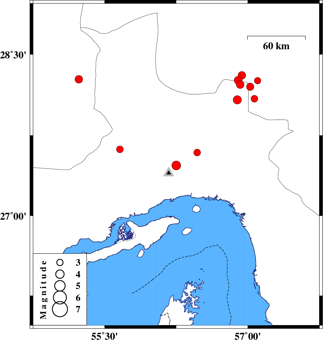
| Prel. Rep. | Date | Time(UTC) | Time(Local) | Lat. | Lon. | Depth | Mag. | Region | Waveform |
|
|
2020/09/09
|
10:42:51.1
|
15:12:51.1
| 27.47 | 56.25 | 15 |
ML4.2
|
Hormozgan Province, 32 km North of Bandar-e abbas | |
|
|
2020/09/02
|
18:11:36.0
|
22:41:36.0
| 28.22 | 56.92 | 26 |
ML3.7
|
Hormozgan Province, 82 km North-West of Kahnuj | |
|
|
2020/09/02
|
18:03:28.3
|
22:33:28.3
| 28.26 | 56.9 | 22 |
ML3.8
|
Kerman Province, 98 km -East of Hajiabad | |
|
|
2020/09/01
|
15:11:42.0
|
19:41:42.0
| 28.2 | 57.025 | 30 |
ML3.5
|
Kerman Province, 71 km North-West of Kahnuj | |
|
|
2020/08/30
|
23:26:22.0
|
03:56:22.0
| 28.257 | 57.102 | 12 |
ML3.1
|
Kerman Province, 67 km North-West of Kahnuj | |
|
|
2020/08/30
|
21:29:22.7
|
01:59:22.7
| 28.306 | 56.938 | 12 |
ML3.6
|
Kerman Province, 101 km -East of Hajiabad | |
|
|
2020/08/27
|
21:42:28.4
|
02:12:28.4
| 27.619 | 55.66 | 9 |
ML3.3
|
Hormozgan Province, 80 km South-West of Hajiabad | |
|
|
2020/08/25
|
21:19:00.7
|
01:49:00.7
| 28.27 | 55.23 | 10 |
ML3.6
|
Fars Province, 66 km -West of Hajiabad | |
|
|
2020/08/22
|
18:40:26.0
|
23:10:26.0
| 28.08 | 56.89 | 10 |
ML3.9
|
Hormozgan Province, 80 km North-West of Kahnuj | |
|
|
2020/08/21
|
14:57:10.8
|
19:27:10.8
| 28.09 | 57.07 | 10 |
ML3.3
|
Kerman Province, 63 km North-West of Kahnuj | |
|
|
2020/08/11
|
17:52:17.9
|
22:22:17.9
| 27.59 | 56.47 | 10 |
ML3.3
|
Hormozgan Province, 49 km North-East of Bandar-e abbas | |