| Prel. Rep. | Date | Time(UTC) | Time(Local) | Lat. | Lon. | Depth | Mag. | Region | Waveform |
|
|
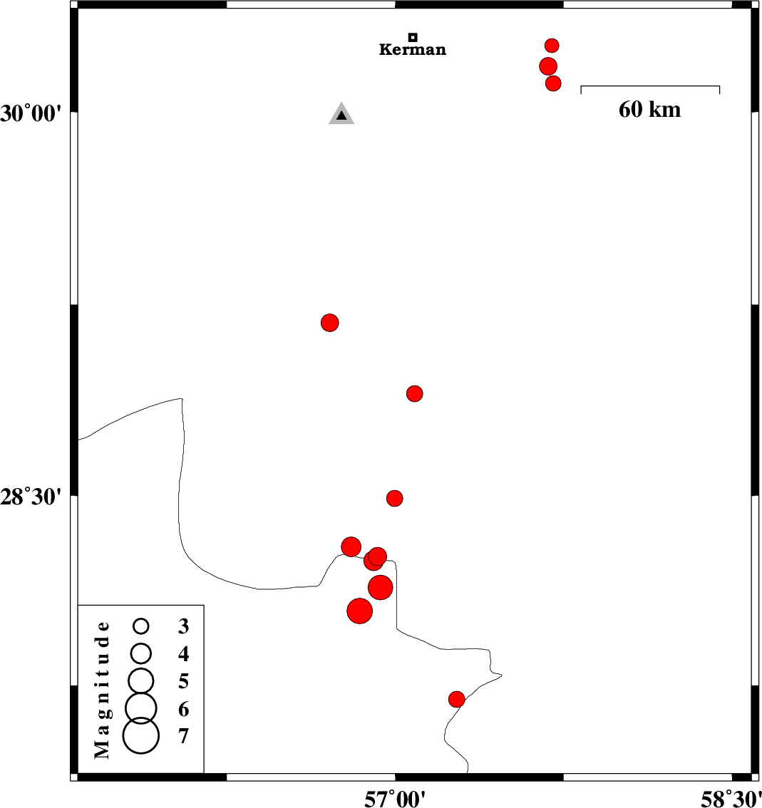
2021/03/30
|
12:02:43.5
|
16:32:43.5
| 28.901 | 57.086 | 15 |
ML3.3
|
Kerman Province, 59 km South-East of Baft | |
|
|
2021/03/25
|
00:33:29.2
|
05:03:29.2
| 27.546 | 55.686 | 12 |
ML3.5
|
Hormozgan Province, 71 km North-West of Bandar-e abbas | |
|
|
2021/03/23
|
05:18:25.8
|
09:48:25.8
| 30.111 | 57.703 | 12 |
ML3.1
|
Kerman Province, 63 km South-East of Kerman | |
|
|
2021/03/17
|
15:10:02.4
|
18:40:02.4
| 30.256 | 57.697 | 12 |
ML2.8
|
Kerman Province, 59 km -East of Kerman | |
|
|
2021/03/15
|
15:40:21.2
|
19:10:21.2
| 29.178 | 56.708 | 12 |
ML3.5
|
Kerman Province, 11 km of Baft | |
|
|
2021/03/14
|
12:54:07.6
|
16:24:07.6
| 28.138 | 56.933 | 10 |
ML4.9
|
Hormozgan Province, 78 km North-West of Kahnuj | |
|
|
2021/03/14
|
12:54:06.7
|
16:24:06.7
| 28.045 | 56.842 | 12 |
ML5.1
|
Hormozgan Province, 84 km -West of Kahnuj | |
|
|
2021/03/11
|
09:19:29.8
|
12:49:29.8
| 30.177 | 57.681 | 12 |
ML3.5
|
Kerman Province, 59 km South-East of Kerman | |
|
|
2021/03/04
|
03:47:57.2
|
07:17:57.2
| 27.695 | 57.274 | 10 |
ML3.3
|
Hormozgan Province, 30 km North of Dehbarez | |
|
|
2021/03/03
|
03:16:05.6
|
06:46:05.6
| 28.299 | 56.804 | 12 |
ML3.9
|
Kerman Province, 88 km -East of Hajiabad | |
|
|
2021/03/03
|
03:00:32.6
|
06:30:32.6
| 28.261 | 56.921 | 12 |
ML3.7
|
Kerman Province, 100 km -East of Hajiabad | |
|
|
2021/03/03
|
02:35:25.5
|
06:05:25.5
| 28.243 | 56.904 | 12 |
ML4
|
Hormozgan Province, 98 km -East of Hajiabad | |
|
|
2021/03/02
|
10:12:01.7
|
13:42:01.7
| 28.489 | 56.998 | 12 |
ML3.2
|
Kerman Province, 75 km South-West of Jiroft | |