سبد خرید خالی است.
خانه / زمین لرزه های اخیر
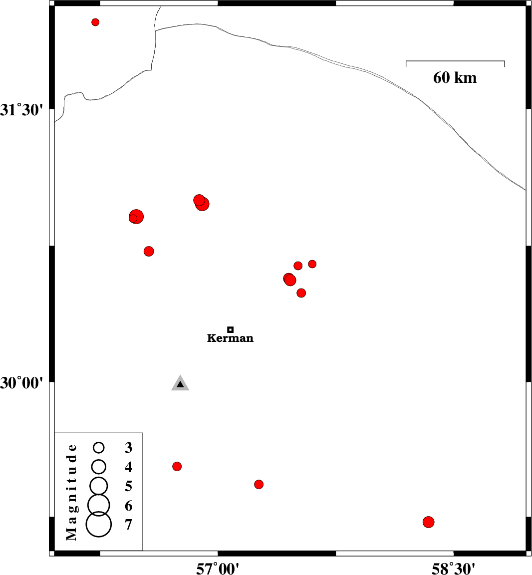
| Prel. Rep. | Date | Time(UTC) | Time(Local) | Lat. | Lon. | Depth | Mag. | Region | Waveform |
| 2014/04/24 | 05:16:31.7 | 09:46:31.7 | 30.56 | 57.46 | 14 | ML:3.2 | Kerman Province, 47 km North-East of Kerman | ||
| 2014/04/24 | 01:45:07.6 | 06:15:07.6 | 30.49 | 57.53 | 16 | ML:2.6 | Kerman Province, 49 km North-East of Kerman | ||
| 2014/04/24 | 01:29:09.6 | 05:59:09.6 | 30.57 | 57.45 | 15 | ML:3.1 | Kerman Province, 48 km North-East of Kerman | ||
| 2014/04/23 | 20:00:49.3 | 00:30:49.3 | 29.22 | 58.34 | 14 | ML:3.2 | Kerman Province, 13 km North of Bam | ||
| 2014/04/23 | 11:15:41.9 | 15:45:41.9 | 30.57 | 57.45 | 14 | ML:2.8 | Kerman Province, 47 km North-East of Kerman | ||
| 2014/04/15 | 02:04:59.9 | 06:34:59.9 | 31.97 | 56.22 | 34 | ML:2.1 | Yazd Province, 88 km North-East of Bafq | ||
| 2014/04/12 | 23:57:08.8 | 04:27:08.8 | 30.64 | 57.51 | 14 | ML:2.4 | Kerman Province, 56 km North-East of Kerman | ||
| 2014/04/12 | 17:15:47.5 | 21:45:47.5 | 30.72 | 56.56 | 14 | ML:2.8 | Kerman Province, 10 km Zarand | ||
| 2014/04/12 | 01:51:38.6 | 06:21:38.6 | 31 | 56.88 | 14 | ML:3.2 | Kerman Province, 31 km South of Ravar | ||
| 2014/04/11 | 23:36:13.3 | 04:06:13.3 | 30.98 | 56.9 | 14 | ML:4 | Kerman Province, 33 km South of Ravar | ||
| 2014/04/06 | 02:23:17.6 | 06:53:17.6 | 30.9 | 56.46 | 14 | ML:2.3 | Kerman Province, 14 km West of Zarand | ||
| 2014/04/05 | 12:16:32.0 | 16:46:32.0 | 30.91 | 56.48 | 14 | ML:4.1 | Kerman Province, 14 km Zarand | ||
| 2014/04/03 | 22:13:44.7 | 02:43:44.7 | 29.43 | 57.26 | 14 | ML:2.6 | Kerman Province, 67 km North-East of Baft | ||
| 2014/04/01 | 15:00:21.8 | 19:30:21.8 | 30.65 | 57.6 | 18 | ML:2.2 | Kerman Province, 64 km North-East of Kerman | ||
| 2014/03/30 | 06:45:38.8 | 11:15:38.8 | 29.53 | 56.74 | 12 | ML:2.5 | Kerman Province, 35 km North-East of Baft |
کلیه حقوق مادی و معنوی این سایت متعلق به پژوهشگاه بین المللی زلزله شناسی و مهندسی زلزله می باشد.
